|
||||
|
2.27 Acre Fox Field Parcel Near Fwy 14 |
||||
|
|
 |
|||
 |
||||
 |
||||
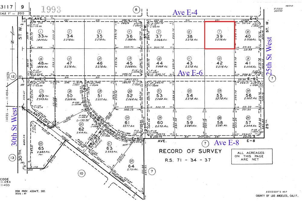
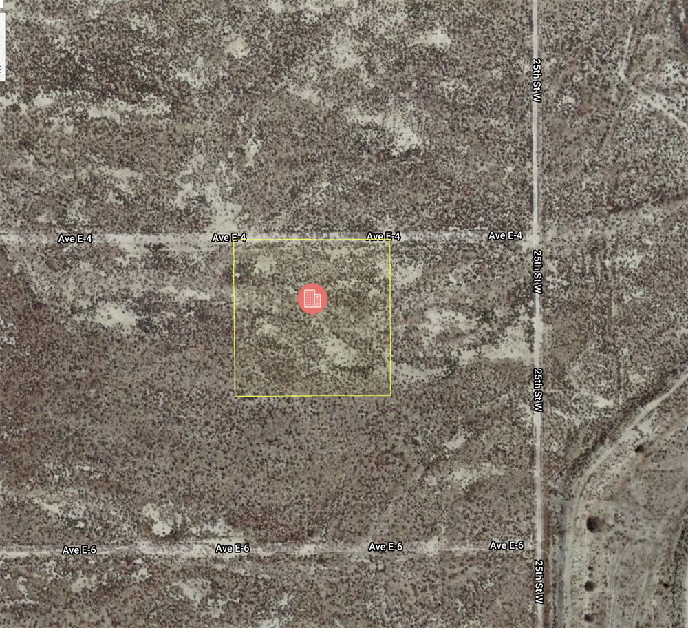
| Location- |
@ 26th St West on Ave E-4 | |
Area- |
NW of Lancaster, Fox Field Specific Plan area | |
Acres- |
2.27 net acres . |
|
APN- |
3117- 9- 7 |
|
Zoning- |
Light Industrial per Fox Field Specific Plan | |
Topography- |
flat & level | |
Dimensions- |
331’ x 299’ (approx.) | |
Utilities- |
elec & tele on paved Ave E | |
Price- |
$32,500 (.33 cents psf) | |
Existing Notes- |
free and clear | |
Terms- |
all cash | |
Remarks- |
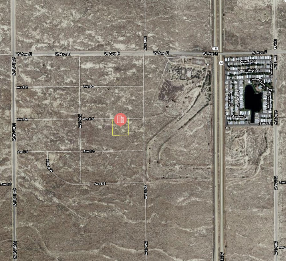
Located NW of Lancaster,
just north of Fox Airfield, in the Fox Field Specific Plan area. Fox Airfield
is a county run airfield used to park private planes and to service industry
and distribution centers in the Fox Field area. Subject parcel is located
at 26th St West, on Ave E-4. All parcels in the Fox Field Specific Plan
area are zoned light industrial, with the
possibility of commercial use if that commerical use meets a current need
for Fox Field businesses. The Fox Field Specific Plan extends from the Fwy 14 to 60th St West and from Ave H, north to Ave E. Sysco Foods, Rite Aid, and Michael’s (art & crafts) have 500,000 to 1M sq foot distribution warehouses in the FF area. Fox Airfield has 7,200 foot runway and 24 hour refueling. The runway is long enough to handle corporate jets bringing in goods for the distribution warehouses in and around the Fox AirField area. Popular area for land investors. Elec is located on paved Ave E, 1/4 mile to the north, right at 25th St West. Highest
& Best use: hold for investment, land bank |
|
Safety and Cautions- |
Anyone inspecting, or walking on the property, off the road, should be aware that rattlesnakes and other desert wild life could be in the area. Be careful and use common sense! | |
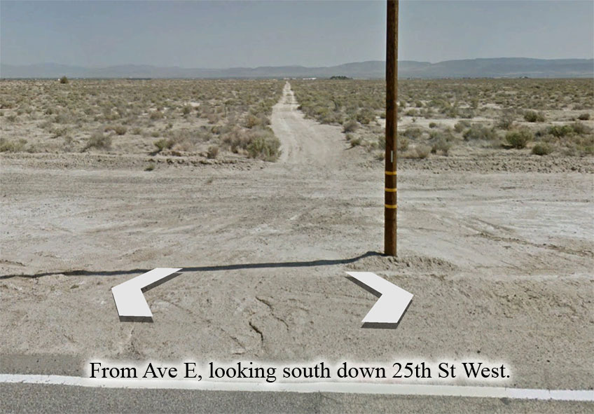
Directions to Property- |
From
the AV Fwy 14, exit at Ave F. Go east on Ave F for 2/10 mile to 20th
St West. Turn left (N) on 20th St West and go 1 mile to Ave E. At Ave
E, turn left (W) and go 1/2 mile, going over the Freeway 14, to 25th
St West. Use odometer, there are no street signs. At 25th St West (see
photo below), turn left (S) and go 1/4 mile (1,320 ft) to Ave E-4. From
this point subject parcel is 330 feet due west on Ave E-4. |
|
 |