|
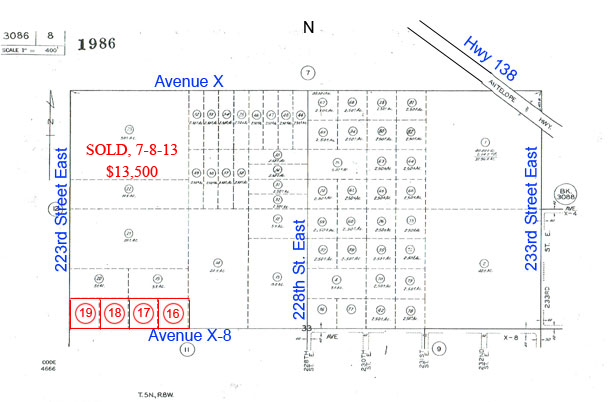
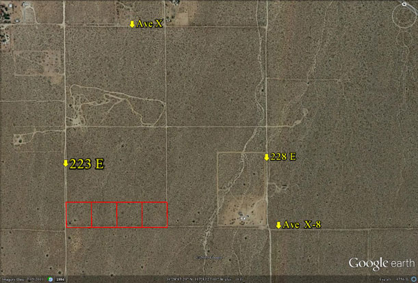
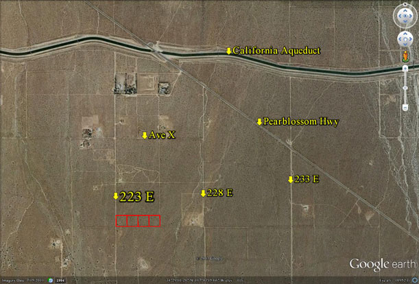
Location-
on 223rd St East, on Ave X-8, NE corner
|
|
|
|
Area-
east of Llano, west of Pinon Hills,
1 mile south of Aqueduct |
|
|
|
Acres- 10
net acres (4, 2.5 acre parcels) |
|
|
|
|
APN-
3086- 8- 16, 17,
18, 19
|
| |
Zoning-
A 1 1, light agriculture, 1 home
per acre
|
|
|
|
Topography-
flat & level |
|
|
|
Dimensions-
330’ x 1320’
|
|
|
|
Utilities-
none to property |
|
|
|
Price-
$15,000 ($1,500 per acre)
|
|
|
|
Existing
Notes- free
and clear |
|
|
|
Terms- all
cash |
|
|
|
Remarks- Located
between the Llano and Pinon Hills regions, 1 mile
south of the California Aqueduct. The ten acres is made up of 4, 2.5
acre
parcels. Each 2.5 acre parcel is a square 330’ x 330’. With
the ten acres
already divided, this allows the new owner to sell one at a time as
the
need or market dictates. No all or none sell decisions.
Subject parcels are flat, with no utilities, but have good dirt road
access to
them. Pearblossom Hwy leads west back into Pearblossom, Littlerock,
and
Palmdale; east to Victorville and the Fwy 15. Zoning of A 1 1 allows
for
1 home per acre and for horses and other farm animals.
Seller will not sell parcels individually.
Most Recent Sales for Area
5 ac 213E & X-8 $2,000 per acre Aug 2011
10 ac 213E & X-4 $2,000 per acre May 2012
10 ac 223E & X $1,800 per acre Aug 2012 .
Buyer to verify the location and access costs of all utilities.
|
|
|
|
SAFETY & CAUTION: Anyone inspecting, or walking on the property,
off the road, should be aware that rattlesnakes and other desert wild life
could be in the area. Be
careful and use common sense!
|
|
|
|
Directions to Property: East
on Pearblossom Hwy (Hwy 138) passing through the communities of
Littlerock and Pearblossom. When you leave Pearblossom you will be
in the
area of 130th St East. Continue eastbound on Pearblossom Hwy (138).
From
130E, you have 10 + more miles to go. At about 213E you will come
to the
Victorville cutoff (Hwy 18), avoid it and stay to the right, keeping
you on
Hwy 138. In about 1 mile, you will pass over the aqueduct.
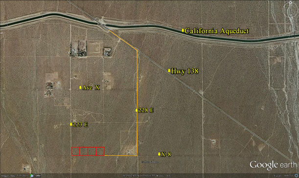
From the aqueduct proceed for 3/10 + of mile, go past 227E, then turn
right
(south) on unmarked dirt road. You should now be driving towards the
mountains.
This road is 228th East. Proceed due south on 228E for 8/10 of a mile.
You have
arrived at Ave X-8. Turn right (west) on X-8 and go 1⁄4 of a
mile. Stop. You
are now at the SE corner of parcel 16, the eastern most parcel.
|